

 |
 |
 |
Caesarea National Park
Israel, Caesarea, 6 March 2009
Overview
On 6 March 2009, Skytamer visited the Caesarea National Park in Israel. We were part of a Grand Circle Tours group that visited, Israel, Egypt and Jordan. Like most tours, you are always rushed to see all that you can.
The following photos were taken during that visit with a Canon G.10 “PowerShot” 14.7 megapixel camera. Behind the majority of the thumbnail photos shown below is a full-size (4,416 × 2,480 pixel) 16:9 HD formatted photo. A few of the photos had been straightened and cropped. Although copyrighted © by Skytamer Images, none of the photos contain messy copyright notices. They all look like they came straight out of your camera … Enjoy! These photos are for your personal use only, and are not to be used for commercial purposes without written permission from Skytamer Images.

Let's start off your tour of the Caesarea National Park by taking a close look at the above Google Earth Satellite image. To the left is Herod's Theatre, and to the extreme right is Herod's Harbor. In between is the Palace, the Hippodrome, the Crusader City, and the rest of ancient Caesarea.
On the site of what was once a Phoenician town, Strato's Tower, King Herod (37-4 BCE) built a resplendent city and named it “Caesarea” in honor of his patron, Augustus Caesar. Its inhabitants - Romans, Samaritans, and Jews - enjoyed the pleasures of the Roman world: water in plentiful supply, bathhouses, and places of entertainment. In 6 CE Caesarea became the seat of the Roman governors. The status of the city's Jews deteriorated, and in 66 CE they rebelled against the Romans. When Jerusalem was destroyed in 70 CE, Caesarea became a Roman provincial capital of Judea.
The city reached the height of its prosperity in the Byzantine period (fourth to sixth centuries CE). It retained its status as an important center of Christian scholarship and its harbor became the gateway to the Holy Land for thousands of pilgrims. The Jewish community grew, and religious academies, where the famous sages taught, were founded in the city. After the Moslems conquered the land in the seventh century, Caesarea's status diminished. In 1101, the Crusaders captured the town. Eighty-six years later, Saladin conquered it and destroyed its walls. The present fortifications were built in 1251 by the French King Louis IX. Following the Mameluke conquest in 1265, the city was abandoned. At the end of the nineteenth century, the Ottoman authorities settled a group of Bosnian Moslem refugees there. The remains of ancient Caesarea attest to the city's illustrious past.
Roman and Byzantine Statuary
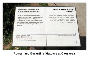
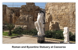
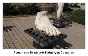
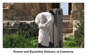
Our tour of the Caesarea National Park started with Roman and Byzantine statuary on display near the entrance of Herod's theater. Most of Caesarea's statues were found headless. Roman statuary, which represented emperors, deities or local dignitaries, remained part of the urban ornament of the Byzantine city, and was sometimes displayed in a Christian context alongside Christian symbols.





Herod's Theater
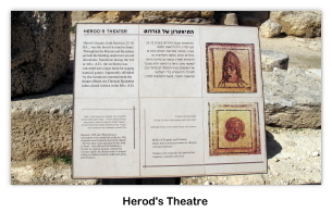
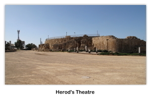
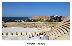
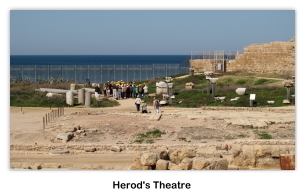
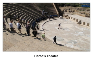
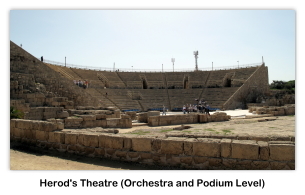
As we entered the upper levels of Herod's theater, we were greeted with a magnificent view of the theater complex with the Mediterranean Sea in the background. The only remnants left from the Theater of Caesarea are rows of seats, the orchestra, the stage and the scena-frons which is an ornamental wall behind the stage. What did it really looked like? Comparisons show that it might resemble the façade of a two or three-story building with elegant doorways decorated with columns, niches and sculptures. After visiting the upper levels of Herod's theater, we proceeded down to the ground or orchestra/podium level of Herod's Theater.






Archaeological Garden
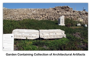
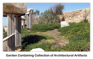
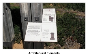
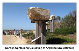
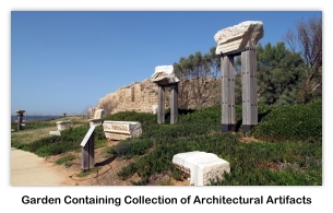
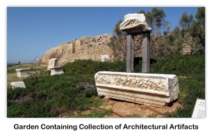
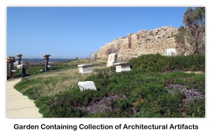
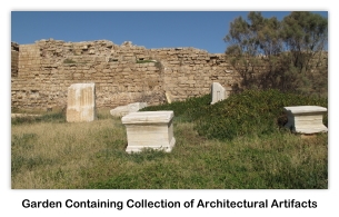
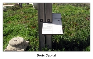
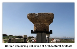
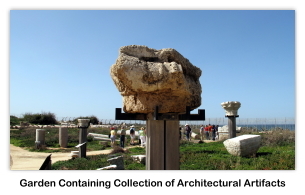
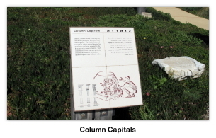
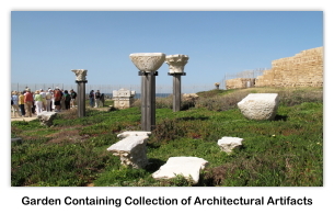
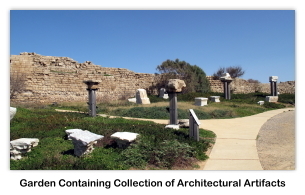
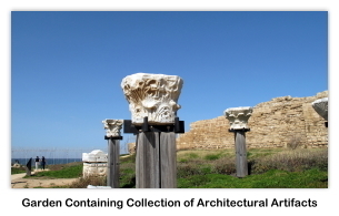
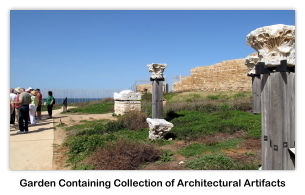
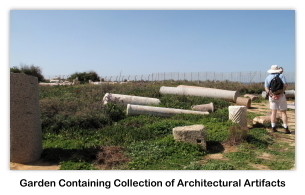
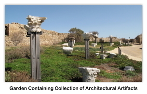
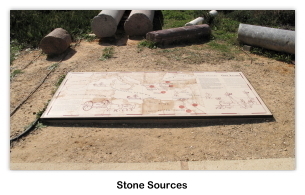
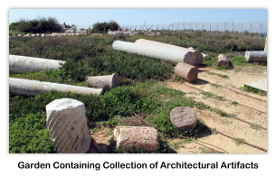
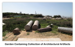
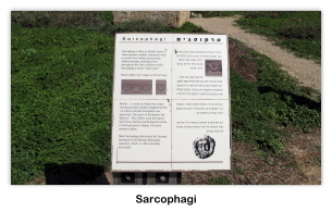
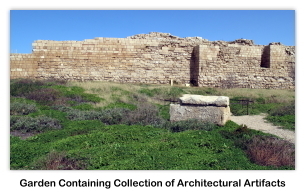
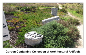
We then proceeded through an “archaeological garden.” This garden presents a collection of archaeological artifacts discovered during excavation of Caesarea, or found by chance.
















Promontory Palace
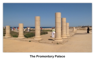
After exiting the “archaeological garden” area, we proceeded on to The Promontory Palace. This palace was Herod's Palace & the Roman Praetorium. Located on one of Caesarea's three sandstone promontories, the Palace affords a superb panoramic view: north to the hippodrome and harbor; southeast, to the theater.
A replica of the site's dedicatory inscription reads: “(Po)ntius Pilatus, the prefect of Judea, (erected) a (building dedicated) to (the emperor) Tiberius”. The original inscription, found in secondary use during the excavations of the theater, is on display at the Israel Museum in Jerusalem. Pontius Pilatus was the Roman prefect who presided over the trial of Jesus of Nazareth (Matt.27:1-26). The content of the inscription and the use of the Latin language hint at the level of Romanization throughout the province, and in Caesarea, at the beginning of the first century CE.




Sea Level
After viewing The Promontory Palace, we proceeded onward to get a sea-level view of the area. Wet feet were the order of the day.


Power and Control
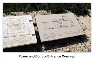
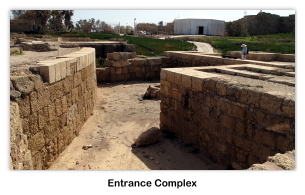
Our next stop was the “Power and Control” Complex, and the Hippodrome. The Praetorium was the symbol of power and control. The Praetorium encompassed some 12,000 m² (of which 5000 had been destroyed by sea erosion). In a later phase, and imposing "Entrance" complex was open unto the east. Offices as well has police and guard rooms were located at the eastern side of the Upper Palace. Within sight of the hippodrome and the theater, the palace subtly reminded the crowds of the might and munificence of the ruler who provided the spectacles. The building was presumably abandoned in the wake of uprisings, which struck the Roman Empire in the mid-3rd century CE.






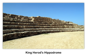
King Herod's Hippodrome
King Herod's 'Hippodrome' — “Herod built (...) on the South quarter, behind the port, an amphitheater also capable of holding a vast number of men conveniently situated for a prospect to the sea” (Josephus Am 1596). This edifice, whose location perfectly matches Flavius Josephus's description, was built for the inauguration of the city in 10/9 BCE. This hippodrome (circus, in Latin), was the venue for the Actian Games instituted by King Herod in honor of the Roman emperor Augustus. The games were held every four years, and included horse and chariot races, athletics, gladiatorial combat and hunting.
Did the buildings serve other purposes as well? In the Greek-speaking eastern part of the Roman Empire, the spectacles as well as the sprint races were held in a building known as the stadium. Historical sources on Caesarea mention a stadium where Jewish, and later, Christian prisoners were sent to their death fighting in the arena as gladiators or as prey for wild beasts. The 315×68 meter building underwent various changes. In the first century CE the Western seating area was added, bringing the structure's capacity to approximately 12,000 spectators. Numbered “bone tokens” were found near the site, suggesting that they were used as admission tickets to the various spectacles.




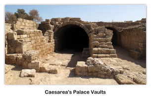
Palace Vaults
The “Palace Vaults” located at the north end of the hippodrome, were a series of four long, parallel vaults, opening onto the west through a portico. They first served as substructures of the Roman financial procurator's palace. In a later stage, a large ornamented hall was added in the fronts of the vaults converted into warehouses. In the early 2nd century CE, one vault was converted into a “Mithraeum” (Shrine of the Persian God Mithras). The contrast between the dark vault and the shaft of sunlight reaching directly the altar from the opening made in the ceiling, played a role in the cult of Mithras, known as the “Unconquered Sun”.




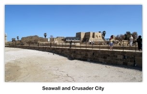
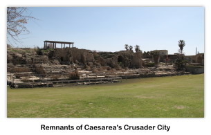
Crusader City
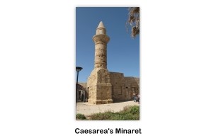
In 638 the city, capital of Byzantine Palestine and an important commercial and maritime center, was conquered by the Muslims, allegedly through the betrayal of a certain Yusef, who conducted a party of troops of Muawiyah through a “secret tunnel”, perhaps the extensive Byzantine sewers, into the city. The Persian historian al-Baladhuri, who offers the earliest Muslim account, merely states that the city was "reduced". The 7th-century Coptic bishop John of Nikiû, mentions "the horrors committed in the city of Caesarea in Palestine". The walls remained, but within them the population dwindled and agriculture crept in among the ruins. When Baldwin I took the city in 1101/2 CE, during the First Crusade, it was still very rich, nevertheless. A legend grew up that in this city was discovered the Holy Grail around which so much lore accrued in the next two centuries. Perhaps the Holy Grail was recovered more than once, for the Genoese found a green glass goblet that they identified as the Chalice and expatriated to Genoa, where it was placed in the church of San Lorenzo.
The city was strongly refortified and rebuilt by the Crusaders. A lordship was created there, as was one of the four archbishoprics in the kingdom. A list of thirty-six Latin bishops, from 1101 to 1496 CE has been reassembled by 19th century papal historians; the most famous of these is probably Heraclius. After that the Latin "Bishop of Caesarea" became an empty title. Saladin retook the city in 1187 CE; it was recaptured by the Crusaders in 1191 CE, and finally lost by them in 1265 CE, this time to the Mamluks, who ensured that there would be no more battling over the site, where the harbor has silted in anyway, by razing the fortifications, in line with their practice in other formerly-Crusader coastal cities.
Caesarea lay in ruins until its resettlement by Circassian and Bosnian refugees as Kaisariyeh in the 1870s and 1880s. Their descendants were expelled during the 1948 War. In the 1950s and 1960s, modern archaeology uncovered details of Crusader ramparts and the theater of the Roman city. More recent work has filled out the picture. Caesarea has recently become the site of what bills itself as the world's first underwater museum, where 36 points of interest on four marked underwater trails through the ancient harbor can be explored by divers equipped with waterproof maps.
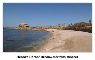




King Herod's Harbor at Caesarea
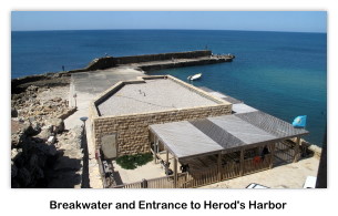
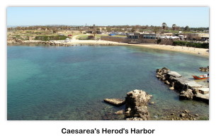
Perhaps one of the most impressive parts of ancient Caesarea was its harbor, Sebastos. At the time it was built in the 1st century BC, Sebastos Harbor ranked as the largest artificial harbor built in the open sea, enclosing around 100,000 m². King Herod built the two moles, or breakwaters, of the harbor between 22 and 15 BCE, and in 10/9 BCE he dedicated the city and harbor to Caesar (Sebastos is Greek for Augustus). The speed of the harbor's construction is stunning considering its size and complexity. The moles were made of lime and pozzolana, a type of volcanic ash, that would set into concrete underwater. Herod imported over 24,000 m³ of pozzolana from Puteoli, Italy, in order to construct the 500 meter long southern breakwater and 275 meter long northern breakwater. At a conservative estimate, a shipment of this size would have required at least 44 shiploads of 400 tons each. Herod also had 12,000 m³ of kurkar quarried to make rubble and 12,000 m³ of slaked lime produced to mix with the pozzolana. However, constructing the moles was just as complicated as obtaining the materials.
In order to build the moles, architects had to devise a way to lay the wooden forms for the concrete moles underwater. One technique was to drive stakes into the ground to make a box and then fill the box with pozzolana concrete bit by bit. However, this method required lots of divers to spend large amounts of time underwater hammering in the stakes and it also used a lot of the valuable pozzolana. Another technique was a double planking method used in the northern breakwater. On land, carpenters would construct a box with beams and frames on the inside and a watertight, double-planked wall on the outside. This double wall was built with a 23 cm gap between the inner and outer layer. Although the box had no bottom, it was buoyant enough to float out to sea because of the watertight space between the inner and outer walls. Once it was floated into position, pozzolana was poured into the gap between the two walls and the box would sink into place on the seafloor and be staked down in the corners. The flooded inside area was then filled by divers bit by bit with pozzolana-lime mortar and kurkar rubble until it rose above sea level.
On the southern breakwater of Sebastos Harbor, another type of construction, called barge construction, was used. The southern side of Sebastos is much more exposed to harsh waves than the northern side, leading it to need sturdier breakwaters. Instead of using the double planked method filled with rubble, the architects constructing the southern breakwater sank barges filled with layers of pozzolana concrete and lime sand mortar. The barges were similar to boxes without lids, and they were constructed using mortise and tenon joints, the same technique used in ancient boats, to ensure they remained watertight. The barges were ballasted with 0.5 meters of pozzolana concrete and floated out to their position. Alternating layers of pozzolana based and lime based concretes were hand placed inside the barge to sink it and fill it up to the surface.
During its height, Sebastos Harbor was one of the most impressive harbors of its time. It had been constructed on a coast that had no natural harbors and it served as an important commercial harbor in antiquity, even rivaling Cleopatra's harbor at Alexandria. The ancient historian Josephus was so impressed with the harbor at Caesarea he wrote, “Although the location was generally unfavorable, [Herod] contended with the difficulties so well that the solidity of the construction could not be overcome by the sea, and its beauty seemed finished off without impediment.” However, while the harbor was impressive on the surface, it had some underlying problems that would soon lead to its demise. Studies of the concrete cores of the moles at Caesarea have shown that the concrete is much weaker than similar pozzolana hydraulic concrete used in various ancient Italian ports. For unknown reasons, the pozzolana mortar did not adhere as well to the kurkar rubble as it did to other rubble types used in Italian harbors. Small but numerous holes in some of the cores also indicate that the lime used was of poor quality and was stripped out of the mixture by strong waves before it could set. Also, large lumps of lime were found in all five of the cores studied at Caesarea, which shows that the pozzolana-lime mixture was not mixed thoroughly, perhaps due to the incredibly rapid construction of the harbor. These structural deficits probably would not have seriously affected the harbor's stability, except for one other detail … the harbor had been constructed over a geological fault line that runs along the coast of Israel. Seismic action gradually took its toll on the breakwaters, causing them to tilt down and settle into the seabed. Also, studies of seabed deposits at Caesarea have shown that a tsunami struck the area sometime between the 1st and 2nd centuries CE. Although it is unknown if this tsunami simply damaged or completely destroyed the harbor, it is known that by the 6th century CE the harbor was unusable and today the moles rest over 5 meters underwater.





The Citadel and the Moat
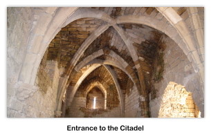
The Crusader harbor was protected with the fortified Citadel, separate from the city by a seawater moat, and connected to a great water by means of a wooden bridge. The bridge bases are clearly noticeable in the wall of the moat.



The Skytamer Archive
This concludes our visit to Israel's ancient city of Caesarea. To learn more about Caesarea, visit the following Wikipedia site. Please remember that the photos used on this webpage are copyrighted © by Skytamer Images, and are for your personal use only. Commercial use of these images requires written permission from Skytamer Images.
References
- Shupek, John, "Skytamer Images Photo Archive"
- Wikipedia Caesarea
- Wikipedia Caesarea Maritima
Copyright © 1998-2019 (Our 21st Year) Skytamer Images, Whittier, California
All rights reserved


